The Somerset Levels and the UK’s Biggest Occasional Temporary Lake
by martinhesp
The older I get, the more I love the Somerset Levels, which is probably the least visited place in all the popular Westcountry. I was there recently for my newspaper, the Western Morning News, reporting on a very interesting debate that’s going on concerning the low lying lands which flood so terribly each winter. Terribly, if you are a farmer, that is. Some environmentalists like the idea that nature is regaining a vast swathe of land…
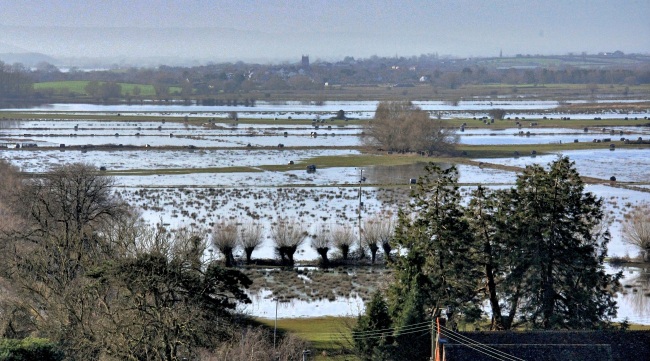
Take a vast area of flat land, send two rivers draining half an entire county’s rainwater to meet in its midst, then watch coastal tides bring silt-laden water 18 miles inland to this same place – and what have you got?
Britain’s largest regular flood. England’s biggest part-time lake. The UK’s biggest ever pumping operation. Threatened farms. Ruined businesses. Some excited environmentalists. A funding gap. Worried locals. A truly contested landscape.
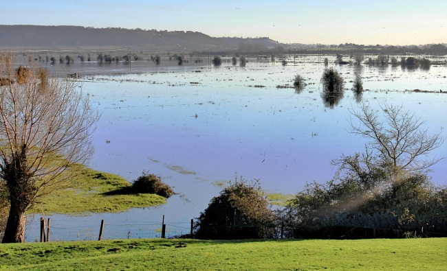
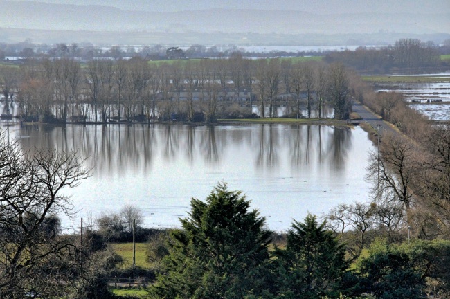
Any one of those answers would apply to the Somerset Levels and Moors which were swamped last year by floods of Noah-like proportions. The great inundation made news headlines – what isn’t so widely known is the story behind the biggest flood to hit the Westcountry in 50 years.
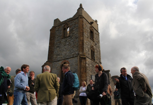
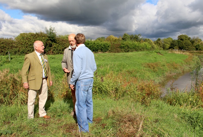
Glastonbury Festival founder Michael Eavis was joined by various Somerset movers and shakers, agricultural leaders and members of the media on Burrow Mump recently to hear the story as the Royal Bath and West of England Society launched a fund to raise over £3 million to dredge some of the area’s key rivers.
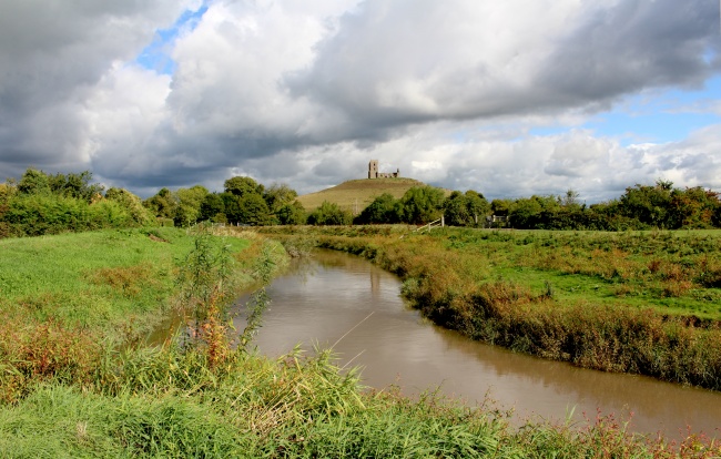
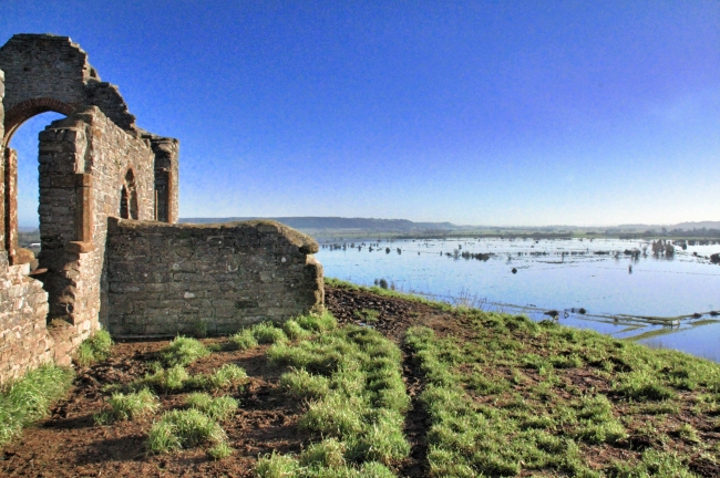
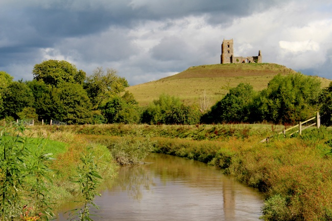
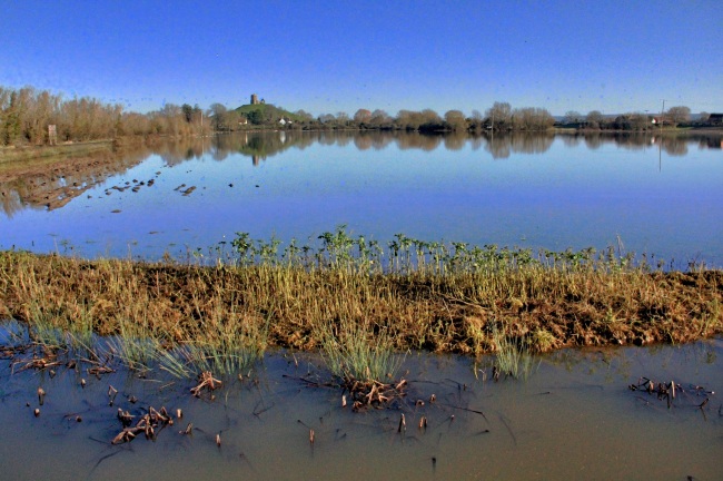
From the hill in the middle of the Levels you could see almost all the flat-lands extending from the Bristol Channel coast all the way inland to Glastonbury, and east almost to Mr Eavis’s Worthy Farm. If the group had stood on the Mump a year ago entire landscape would have reflected the blue of a cloudless sky.
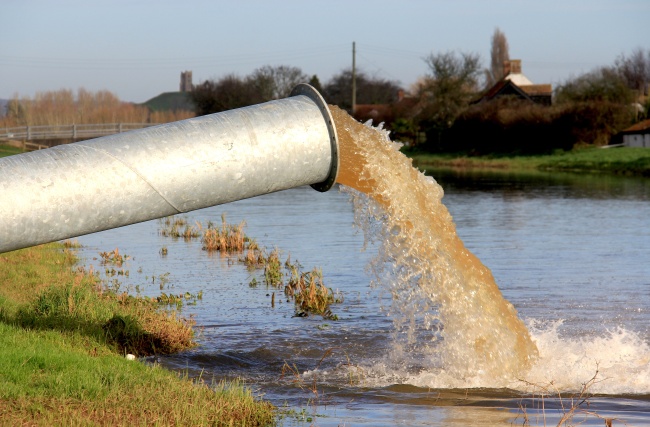
In places floods covered the lowlands to depths of more than four metres – and the UK’s biggest ever pumping operation was required to get the water out. On the Mump this week a farmer told how some of his land had been covered by water for more than 12 months – how half his farm had been rendered useless for 23 months – how he’d had to borrow “hundreds of thousands” to keep his business going.
Something, the people on the Mump were told, needed to be done…
It used to be done. The Levels, we learned, did not flood to such lake-like proportions back in the days when the rivers were dredged properly.
From our vantage point we could see the place where the Rivers Tone and Parrett join in their mission to take half Somerset’s water to the sea. We are talking about the waters of eastern Exmoor, Tone Vale, half the Blackdowns, a swathe of Dorset eminences, and so on…
All meeting at a low-lying confluence so narrow you could almost spit across it.
And here’s the added fact which would have inspired Noah to build his Ark up on the Mump. Despite being 18 miles upstream from the coast, the rivers here are tidal. And the second biggest tide-fall in the world also happens to be one of the muddiest. What the Bristol Channel does twice a day, everyday, is pump silt up to the Tone-Parrett pinch-point – and just about everywhere else it can reach. Silting means flooding.
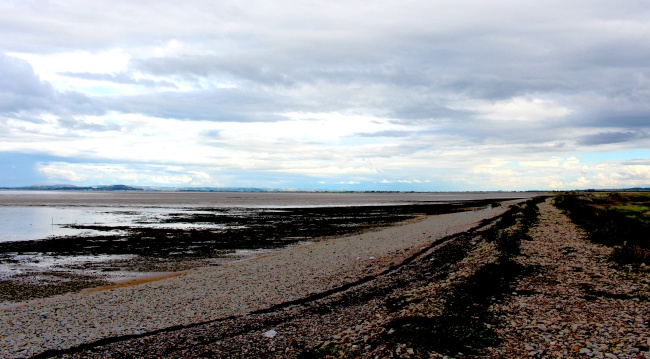
(Somerset coast where the Levels meet the sea)
Which is why people like Mr Eavis were standing on the Mump bearing worried expressions… The man behind the biggest music festival on Earth is also a dairy farmer, and he told me: “I’m a proper native. I’ve been going down through the moors all my life and when they’re properly drained, they’re beautiful. But it’s all cock-eyed at the moment because of a lack of any attention over the last 25 years.
“People use to use drag-lines and dredge – it’s such a simple operation and needs to be kept going,” he added. “Farmers are going bust because they can’t get the winter forage in for the cattle – and that is serious. For them, it is a very pressing plight and it has to be dealt with now, otherwise there will be no recovery.”
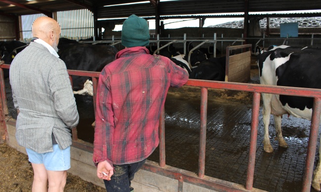
(Michael Eavis studies cows that normally graze on The Levels)
Now, in a bid to alleviate the problem, the Royal Bath and West of England Society has launched its £3million-plus dredging fund. Edwin White, chairman of the society’s agricultural policy group, explained: “We’ve been doing this sort of work for nearly 250 years – in the early days the society was involved in schemes in the Levels – so we have a long history.
“The first thing people think when they see the big lake is: ‘Thank God I don’t farm there.’ We had a group of farmers come over from the east of England and they were absolutely horrified. They saw farmers who’ve had to sell their stock. They saw businesses who couldn’t operate, and they saw roads closed.
“The area affected is 15 per cent of the county of Somerset. We have to ask the Government – what do you want of this land? Do you want to compensate farmers and say – we want a bog for the wading birds, fauna and flora etc? Or do you want it as productive land? At the moment the Environment Agency (EA) is trying to say – we want both. But both doesn’t work…”
When it comes to dredging, the EA doesn’t get too good a press on the Levels. I put it to area flood and coast-risk manager, Nick Lyness, that his agency’s decision to cut back on dredging was at the heart of the watery problems…
“The reality is that we haven’t had a big enough pot of money,” he replied. “ It is a huge problem. Last year was a particularly bad one, but was part of an ongoing problem. How do you maintain a location where the silt comes in twice a day with the tide? It is expensive.
“And to keep it going means you have to spend a large amount of money all the time. It is great to see Somerset stepping up to the plate to try and find the money for the funding gap. But after that, how do you make sure that every year there’s money available?
“Last year this region had over 200 communities flooded – £400 million worth of damage to the flood defences,” said Mr Lyness who admitted that the EA had spent a large amount on last year’s pumping operations on the Levels.
“It was a difficult decision,” he said. “You think – we divert this money elsewhere if we turned the pumps off. So I think the work of the task force that’s been set up is very important. How will people view the Levels and moors over the next 20 or 30 years? The answer to that could give a bit more confidence when it comes to where funding can come from.”
The task force Mr Lyness refers to is being chaired by one time NFU executive Anthony Gibson who lives locally, and he told the WMN it had been set up to bring all the many interest groups together…
“We need to decide what we want this area to be like in the future and then construct mechanisms to make that happen,” said Mr Gibson. “There does seem to be a broad consensus between the two main protagonists – that’s the environment lobby and the farming lobby – that a) they want it to continue to be farmed; and b) to be farmed in a way that’s going to produce things besides food. That’s the landscape and the unique wetland ecology that has made the Levels so important.
“What it is not is a vision of the Somerset Levels reverting to a vast primeval swamp,” he told me. “There are some environmental fundamentalists who would like that – and it is the cheapest option, so it suits elements in Government and the EA to say let nature take its course.
“But there’s a strong feeling here that we shouldn’t do that,” he added. “Nature does need management in order to achieve an outcome that everybody wants. And we have to start by managing the rivers. Unless we do that we can encourage wetland agriculture and create conservation areas – but if everything is underwater for months and is killed, it is a waste of time.”
From the environmental lobby Mark Robins, senior policy officer for the RSPB, told the WMN: “The route map between where the Levels are now and a much brighter future does, indeed, go via water and its management.
“But the question is – what’s the destination? Could we dare to think this might be the Levels and Moors as one of the great natural spectacles of Europe? Where rural Somerset reaps the economic, environmental and community welfare benefits that this could bring?
“Or are we still looking at the same problems, through the same eyes and with the same solutions?” asked Mr Robins. “With climate change bringing more floods and more droughts – and with much less public investment around – are there opportunities ahead for a fair, planned, nature benefiting, and efficient, transition? There’s got to be, but I’m not sure yet if we are walking into a different future but looking backwards?”
One man who does not want to look backwards is farmer Anthony Gothard, of Stoke St Gregory, who hosted this week’s fund launch…
“We expect a certain amount of flooding,” he told me. “But last year we had 120 acres underwater for 12 months. It did not see daylight for a year. We had another 240 acres – that’s half our farm – out of production for 23 months.
“So people see the lake and say: ‘Just let it flood.’ But once these areas start flooding it can reach parts of Bridgwater and elsewhere. And this is some of the most productive land in Somerset. Do we want to see it in ruins?
“We support 12 families in my business, plus all the suppliers – if we go out of business, that’s a big impact locally. And that’s just my farm.
“If this happens again next year we will be out of business,” said Mr Gothard. “The banks supported us to the tune of hundreds of thousands – but it was a one-off. If it happened again, we would fold.
“People have given up already. So all this land – what’s going to happen to it? The smell here was incredible after the floods – plus we had a mosquito problem. Is that what people want?”
It is a question that will be asked again and again if the rain returns to fall like it did in 2011 and 12.

